Jakarta, (Antara Sumbar) - As a satellite-data provider, the Integrated Maritime Information System (SEMAR) has supported fishermen to increase their productions, while supervising the illegal boats sailing in the Indonesian waters since the past years, a public relations officer of National Institute of Aeronautics and Space, Rizki, said here on Thursday (Sept 21).
During the Indonesia Business & Development (IBD) Expo 2017, the Space Agency showcased some satellite prototypes, such as LAPAN-A2/Lapan Orari and LAPAN-A3/LAPAN IPB, both of which were used to support the work of SEMAR system.
"As part of Decision Support System (DSS), SEMAR would not only provide information on the coordinates of the fishing and other maritime resources but would also map every ship and boat sailing throughout Indonesian territories, including in the border areas," he remarked in Jakarta on Thursday.
In its operation, the Space Agency has collaborated with the state-owned telecommunication company, PT INTI, mainly in terms of supporting the system's software. The system, moreover, also accesses some data predictions on atmosphere, sea current, water temperature, and fishing zone potentials from several providers, including SADEWA and Hybrid Coordinate Ocean Model (HYCOM).
"The program has been operated in a coastal district of Indramayu in West Java province. The system now has covered about 90 percent of the district's waters," Rizki remarked.
Apart from mapping the fishing zone, the system also functions to supervise the illegal boats sailing in the Indonesian waters.
"Since we have records on every boats in the country, the system could map every unknown vessels, which are likely to commit illegal, unreported, and unregulated (IUU) fishing in our country's territory," he pointed out.
The program, he further explained, would process the information on the ship movement with the Automatic Identification System (AIS), a software installed in the agency's two satellites of LAPAN-A2 and LAPAN-A3.
After processing the information, the space agency will deliver the results, such as fishing zone coordinates, to the Fishery and Maritime Agency (DKP) in all provinces.
"Thanks to SEMAR, now the fishermen will no longer have to wait for the fish, because they already know where it would be found," Rizki reiterated. (*)
Editor: Vicha Faradika
"SEMAR" Supports Fish Productivity, Helps Tackle Illegal Fishing: LAPAN
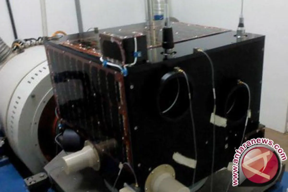
Lapan A2. (Antara)


